Harvey Downgraded To Tropical Storm But Power Outages and Flooding Threat Continues
National Hurricane Center says "extremely serious flooding event is now unfolding."
Saturday, 26 August 2017 14:30:00 -05:00
The National Hurricane Center has downgraded Harvey to a Tropical Storm. However, the worst effects of the storm may still be on their way as Harvey is expected to produce total rain accumulations of 15 to 30 inches and isolated maximum amounts of 40 inches over the middle and upper Texas coast through Thursday. During the same time period Harvey is expected to produce total rain accumulations of 5 to 15 inches in far south Texas, the Texas Hill Country and southwest and central Louisiana. Rainfall of this magnitude will cause catastrophic and life-threatening flooding.
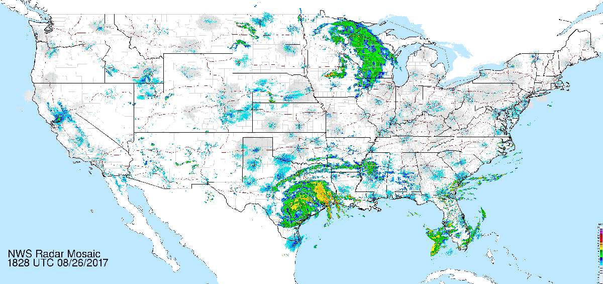
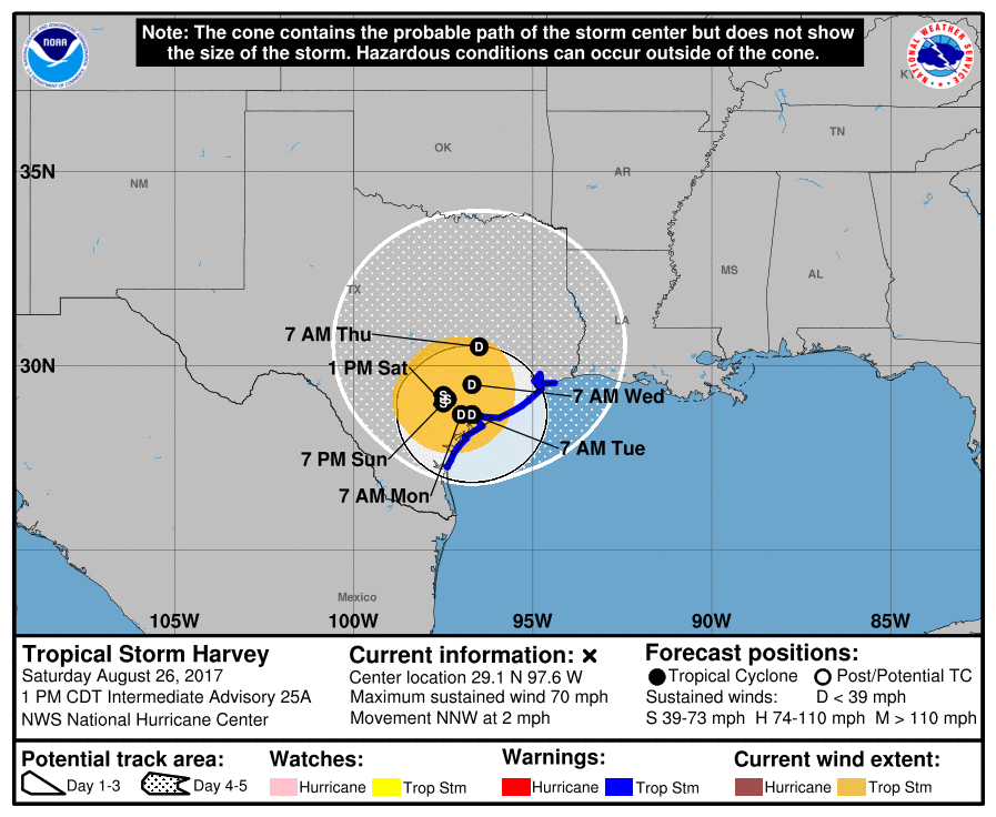
At 100 PM CDT (1800 UTC), the center of Tropical Storm Harvey was located by National Weather Service Doppler radar near latitude 29.1 North, longitude 97.6 West. Harvey is moving slowly toward the north-northwest near 2 mph (4 km/h), and little motion is anticipated during the next several days.

Maximum sustained winds have decreased to near 70 mph (110 km/h) with higher gusts. Additional weakening is forecast during the next 48 hours.
The ContactRelief Disaster Decision Engine team is monitoring the continuing power outages and developing flooding situation. As of 1 PM, approximately 243,000 people were without power. Our recommendation to suspend contact with consumers in the affected regions remains in force, and new recommendations for additional counties will soon be released to address the developing flooding threats.
Protect your brand AND revenue when disaster strikes.
Try ContactRelief FREE for 30 days. Discover how we can help you reach up to 5x more customers in a disaster zone – while protecting your brand image.
Start free trial