Harvey Makes Landfall for the Second Time
Tropical Storm Harvey made landfall for the second time early Wednesday morning near Cameron, Louisiana.
Wednesday, 30 August 2017 07:00:00 -05:00
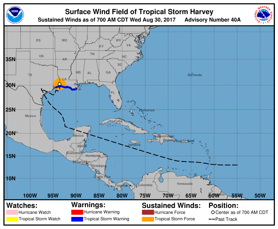
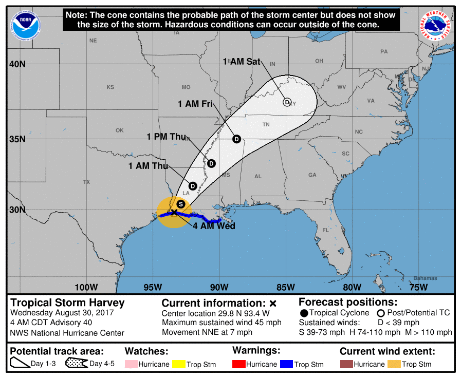
Tropical Storm Harvey made landfall for the second time early Wednesday morning just west of Cameron, Lousiana. In its 4:00 AM CDT advisory, the National Hurricane Center said that "catastrophic and life-threatening flooding continues in southeastern Texas and portions of southwestern Louisiana." Harvey is moving toward the north-northeast near 7 mph. A north-northeastward and then northeastward motion at a faster forward speed is expected through Thursday night. The center of Harvey is expected to move across the Lower Mississippi Valley and Tennessee Valley through Thursday while weakening to Tropical Depression strength.
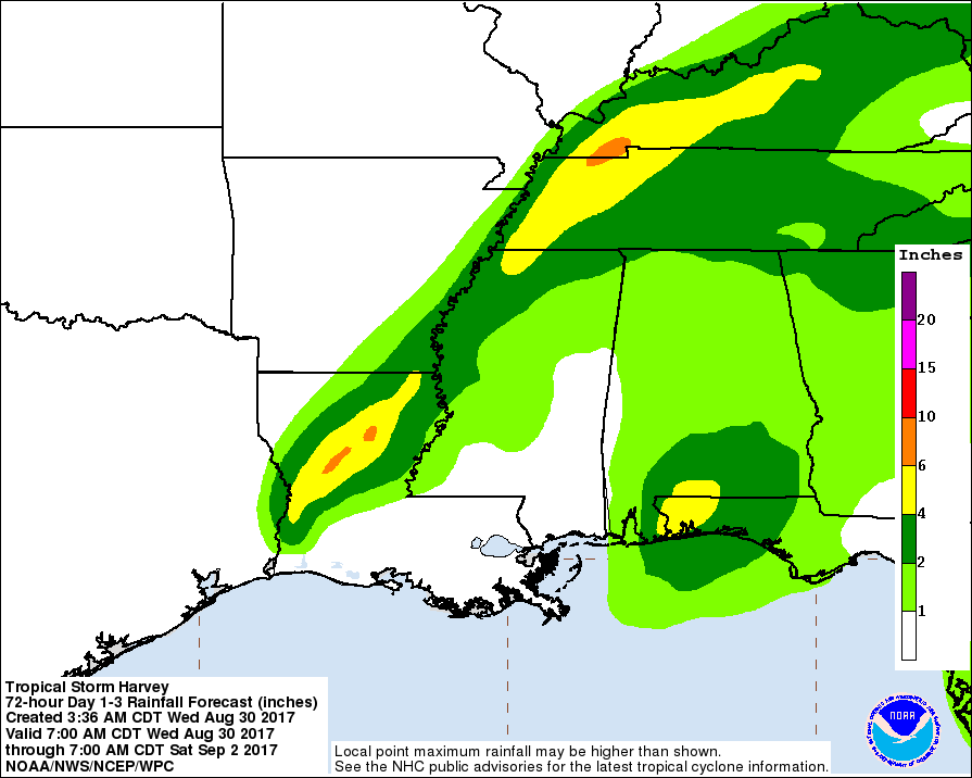
An additional 3-6 inches of rain is expected over large sections of Louisiana with isolated sections getting up to 10 inches of rain. Harvey has already broken records having dumped over 51 inches of rain on southeast Texas.
Want to know precisely who NOT to contact during a disaster?
Find out with a free trial