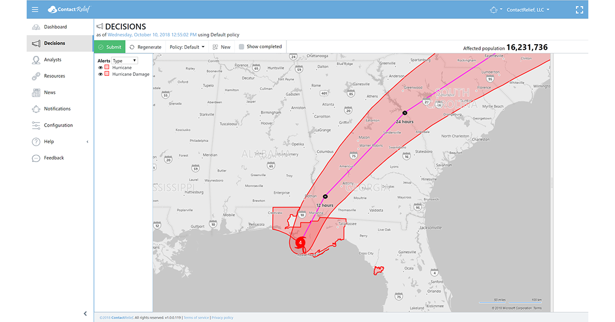
Hurricane Michael Makes Landfall As Category 4 Hurricane
Sustained winds near 150 mph batter Florida coastline
Wednesday, 10 October 2018 13:30:00 -05:00
Hurricane Michael Update
Hurricane Michael made landfall near Mexico Beach, Florida around 12:30 PM as a strong Category 4 hurricane. Maximum sustained winds at time of landfall were near 150 mph. Over 500,000 Florida residents are now without power. Officials expect power outages to ultimately affect millions of residents as the storm moves through the Florida Panhandle and into Georgia.ContactRelief's Disaster Decision Team is monitoring the storm and determining the areas with minor, moderate, severe, and extreme damage. Areas with minor damage are shown in the graphic above. Contact should be suspended in areas under Hurricane Warning, Hurricane Watch, Tropical Storm Warning, and Storm Surge Watch and Warning alerts. We expect to maintain this recommendation for 48 hours and to issue additional Hurricane Damage alerts and suspension recommendations for longer periods in the areas with moderate or higher damage.
To obtain the list of affected ZIP Codes, become a ContactRelief subscriber today.
With ContactRelief's Disaster Decision Engine, your company can avoid disasters by shaping the customer experience.
Schedule Your Product Demo Now!
Don't Delay
The next disaster is on its way. Become a ContactRelief subscriber and keep your company protected from disaster. Our full recommendations consist of the areas to be suspended and the list of zip codes covering these areas. With minimal effort, your company can quickly implement a solution that protects your company and its customers. As we say at ContactRelief, "It's just smart business."
Contact sales@contactrelief.com for more information.
Are you prepared for the next disaster?
Disasters can strike at a moment’s notice. That’s why, at ContactRelief, we provide round the clock disaster monitoring to keep your operations ahead of disasters. With timely, comprehensive recommendations that are accurate to the ZIP code, ContactRelief ensures you focus less on the disaster, and more on your operations.
Contact sales@contactrelief.com for more information.