Hurricane Lane Weakening, Moving North Towards Oahu
Catastrophic Flooding on the Big Island of Hawaii
Friday, 24 August 2018 10:30:00 -05:00
Free ContactRelief Damage Assessments for Hurricane Lane
The ContactRelief Disaster Decision Team is compiling damage assessments for Hurricane Lane as it moves through the Hawaiian Islands. Contact centers should suspend contact to areas under threat or damaged by the storm. For a limited time, you can obtain the list of ZIP Codes for the affected areas without charge. The ContactRelief Decision Team will track the storm, monitor the areas for damage, and update this ZIP Code list as events unfold.
To obtain this list, contact us at sales@contactrelief.com.
Hurricane Lane Update
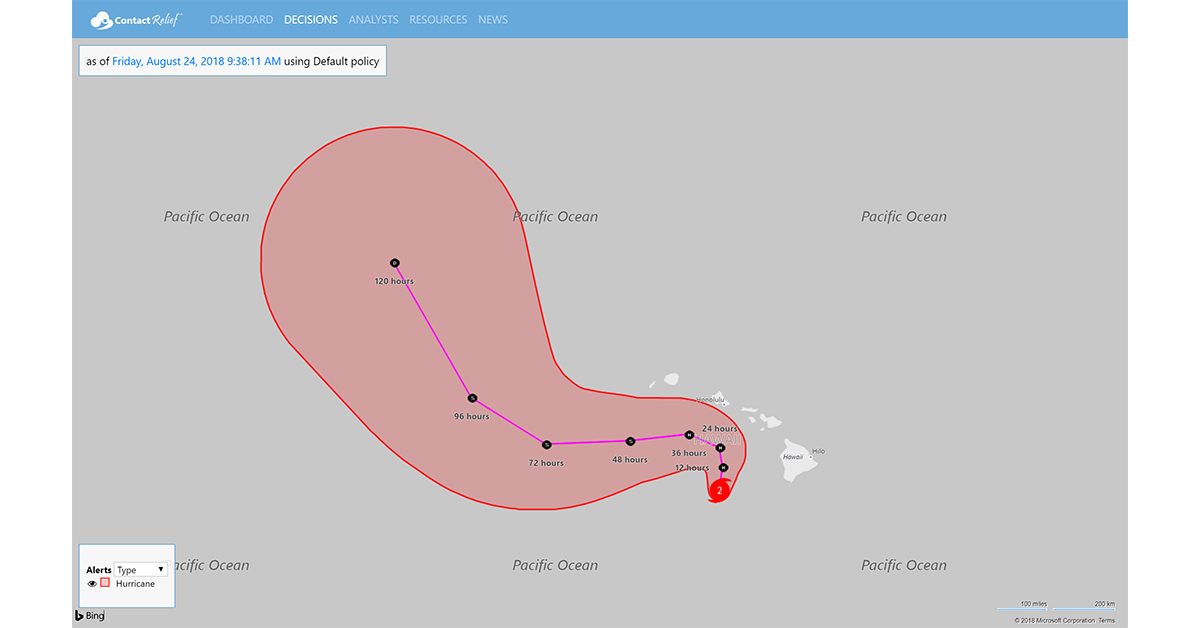
Hurricane Lane weakens to Category 2 strength as it makes its way slowly North toward the island of Oahu. As of 5:00 AM HST, the center of Lane was located at about 145 miles (230 km) west-southwest of Kailua-Kona, Hawaii near latitude 18.7 North, longitude 158.0 West. The storm is moving slowly north at 5 mph (7 kph).
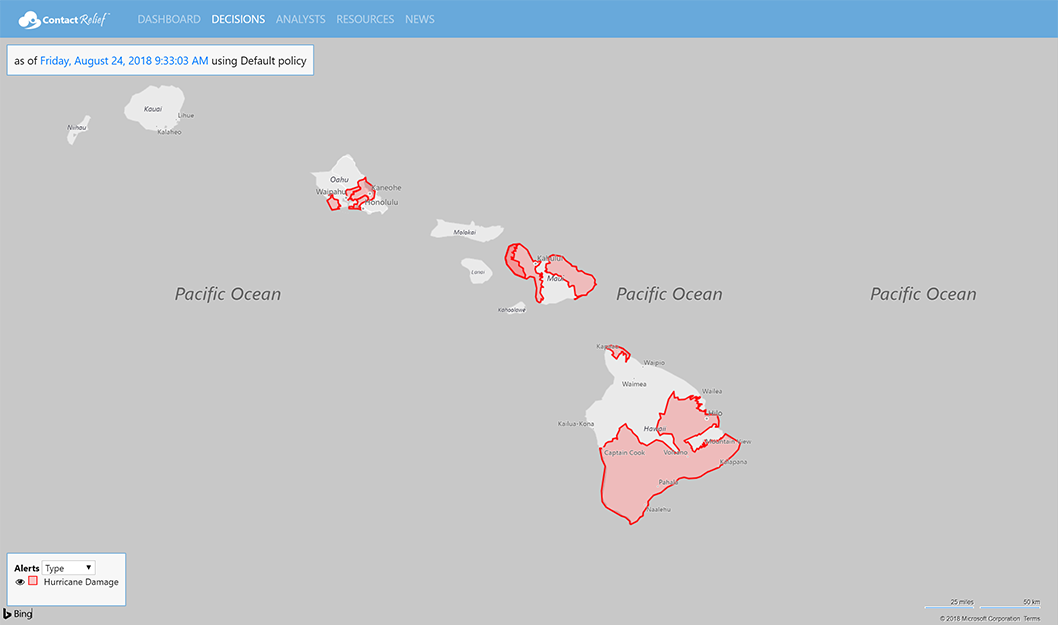
Catastrophic flooding has been reported on the Big Island of Hawaii. Multiple road closures are in effect and hundreds of people have been evacuated due to potential flooding. So far damage to homes and other structures has been somewhat limited but more rain is expected. Over 30" of rain has fallen in some areas and forecasters say that the rain could continue through Saturday throughout the islands.
As the storm moves north it is expected to weaken further. The current forecast track has high uncertainty but a major turn west is very certain and will keep the storm from making landfall with the northern islands. The turn west is caused by a high-level wind shear that will separate the upper and lower portions of the storm. The lower portion will move on the forecast track to the west. The upper portion will remain somewhat stationary dumping more rain on the islands.
The storm surge from Lane is only at 2-4 ft so the flooding is expected to be largely driven by rain as opposed to storm surge driven coastal flooding. However, officials have warned those in coastal areas to be cautious and prepared to evacuate.
Recommendations for Contact Centers
ContactRelief recommends suspension of contact with consumers in the Hurricane Warning, Hurricane Watch, and Tropical Storm Warning areas. Damage on the Big Island, Maui, and Oahi has been reported. See the ContactRelief Hurricane Damage alerts for more information.
The ContactRelief Disaster Decision Team will continue to monitor the storm's development and issue additional advisories as warranted. To obtain, the full list of affected ZIP Codes, become a ContactRelief subscriber.
For as little as $400 per month, your company can avoid disasters by shaping the customer experience.
Schedule Your Product Demo Now!
Don't Delay
The next disaster is on its way. Become a ContactRelief subscriber and keep your company protected from disaster. Our full recommendations consist of the areas to be suspended and the list of zip codes covering these areas. For as little as $400 per, month your company can quickly implement a solution that protects your company and its customers. As we say at ContactRelief, "It's just smart business."
Contact sales@contactrelief.com for more information.