Hurricane Florence Makes Landfall on North Carolina Coast
Hundreds in need of water rescues in North Carolina
Friday, 14 September 2018 08:50:00 -05:00
ContactRelief Recommendations for Contact Centers
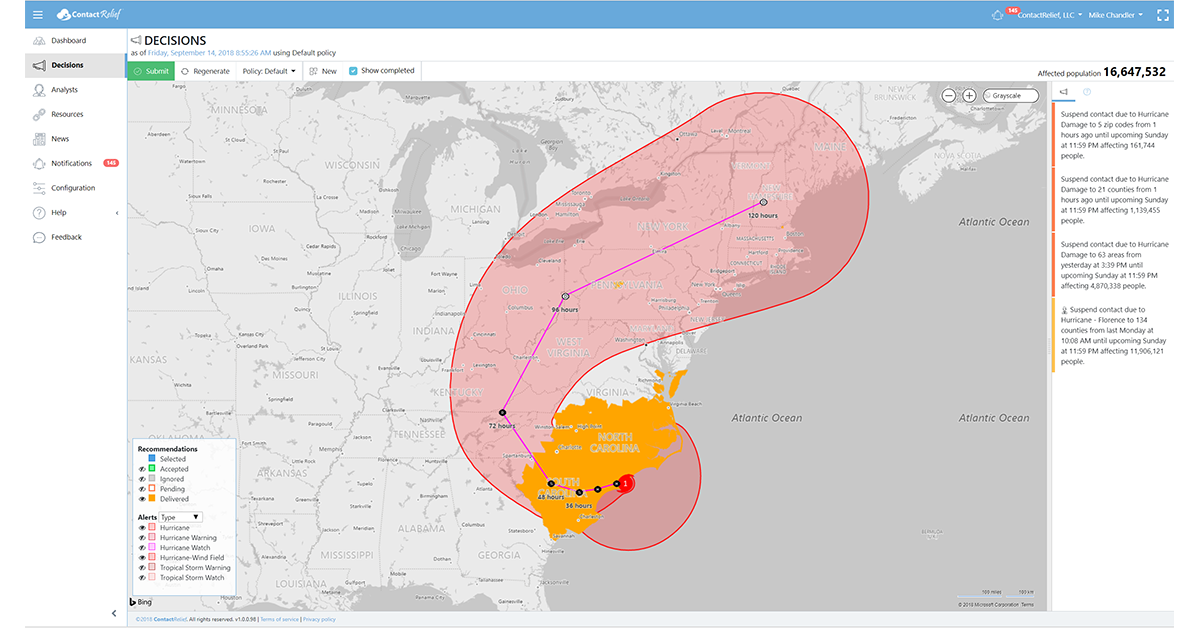
ContactRelief is making public recommendations first made to subscribers on Friday, September 14th, 2018. ContactRelief recommends suspending contact with (or continuing suspension of contact with) parts of South Carolina, North Carolina, and Virginia due to the impending landfall of Hurricane Florence. The recommended area has been extended today as the storm moves inland to cover parts of southern Virginia that will be experiencing the storm's outer rain bands and parts of inland North and South Carolina that will experience tropical storm force winds or outer rain bands in the coming hours.
To obtain the list of affected ZIP Codes, become a ContactRelief subscriber today.
Hurricane Florence
Hurricane Florence made landfall near Wrightsville Beach, North Carolina at 7:15 AM EST as a Category 1 storm with 90 mph winds. Landfall occurred slightly earlier than expected and this is seen as good news by forecasters as interaction with the land will continue to weaken the storm. This good news is offset by Florence's slow, plodding movement south before tracking inland which will bring the heaviest rainfall for at least another 12 hours to already rain-soaked North Carolina.
Forecasters believe that storm surge and rain-driven flooding will likely be the most significant cause of property damage and injuries. The storm surge is expected to continue through Friday into Saturday as tropical storm force winds continue to affect the Carolinas and southern Virginia. Coastal flooding is expected 40 miles north and south of Wilmington, North Carolina. The historic rainfall previously forecasting appears to be even more likely now as 10 inches of rain has fallen over major coastal areas with some regions already reporting up to 20 inches of rain. An additional 8 to 10 inches of rain is expected. River flooding is expected to continue into next week.
Damage reports from the storm are beginning to roll in. The most significant damage at date has been from storm flooding with the city of New Bern, North Carolina reporting hundreds of water rescues.
ContactRelief is monitoring the storms
The ContactRelief Disaster Decision Team will continue to monitor the development of these storms and issue additional advisories as warranted.
With ContactRelief's Disaster Decision Engine, your company can avoid disasters by shaping the customer experience.
Schedule Your Product Demo Now!
Don't Delay
The next disaster is on its way. Become a ContactRelief subscriber and keep your company protected from disaster. Our full recommendations consist of the areas to be suspended and the list of zip codes covering these areas. With minimal effort, your company can quickly implement a solution that protects your company and its customers. As we say at ContactRelief, "It's just smart business."
Contact sales@contactrelief.com for more information.